NASA Flood Tracking Gets Local
NASA Flood Tracking Gets Local
Floods are no longer rare disasters that arrive with days of warning and clear boundaries. They are fast, chaotic, and increasingly expensive. That is why NASA flood tracking is moving from orbiting satellites and federal dashboards into the hands of researchers focused on local risk. At the University of Texas at El Paso, researchers are using NASA technology to better detect, map, and understand flooding as it unfolds. The stakes are practical: better data can mean faster warnings, smarter infrastructure planning, and fewer communities left guessing when water starts rising. For border regions, desert cities, and places where extreme rainfall can overwhelm aging drainage systems in minutes, this is not just science. It is public safety with a satellite backbone.
- UTEP researchers are applying
NASAtechnology to improve flood detection and tracking. - The work could help communities map risk faster and respond more effectively during extreme weather.
- Satellite-based tools can fill gaps where ground sensors and flood gauges are limited.
- The project reflects a larger shift toward climate resilience powered by remote sensing and local expertise.
NASA Flood Tracking Moves From Space Data To Street-Level Risk
The obvious promise of NASA flood tracking is scale. Satellites can see what ground-based systems often miss: water spreading across large areas, runoff moving through terrain, and flood impacts in places without dense sensor networks. But the harder challenge is translation. Raw satellite observations are not automatically useful to emergency managers, city engineers, or residents deciding whether a road is safe.
That is where university researchers matter. UTEP’s work sits in the crucial middle layer between space-based observation and community action. The goal is not simply to admire sophisticated remote sensing tools. It is to turn those tools into usable intelligence: where flooding is happening, how quickly conditions are changing, and which areas may be vulnerable next.
The real breakthrough is not that satellites can see floods. It is that local researchers can adapt that data to the messy geography, infrastructure, and weather patterns of a specific region.
Flooding is deeply local. A model that works well for a river basin in the Midwest may struggle in a desert city where hard soil, arroyos, pavement, and short bursts of intense rain produce rapid runoff. El Paso and the surrounding region present exactly that kind of test case. When water moves quickly through dry terrain, warning time can shrink dramatically.
Why NASA Flood Tracking Matters Now
The timing is not accidental. Climate change is increasing the volatility of rainfall. Even places associated with drought are facing more intense precipitation events when storms do arrive. That creates a brutal infrastructure paradox: cities must prepare for both too little water and too much water, often with systems built for older climate assumptions.
Traditional flood monitoring depends on tools like stream gauges, rainfall stations, field reports, and hydraulic models. Those remain essential, but they have limits. Sensors can fail. Gauges may be sparse. Floodwaters can appear in locations that were never considered high priority. In fast-moving urban floods, the first reliable signal may come too late.
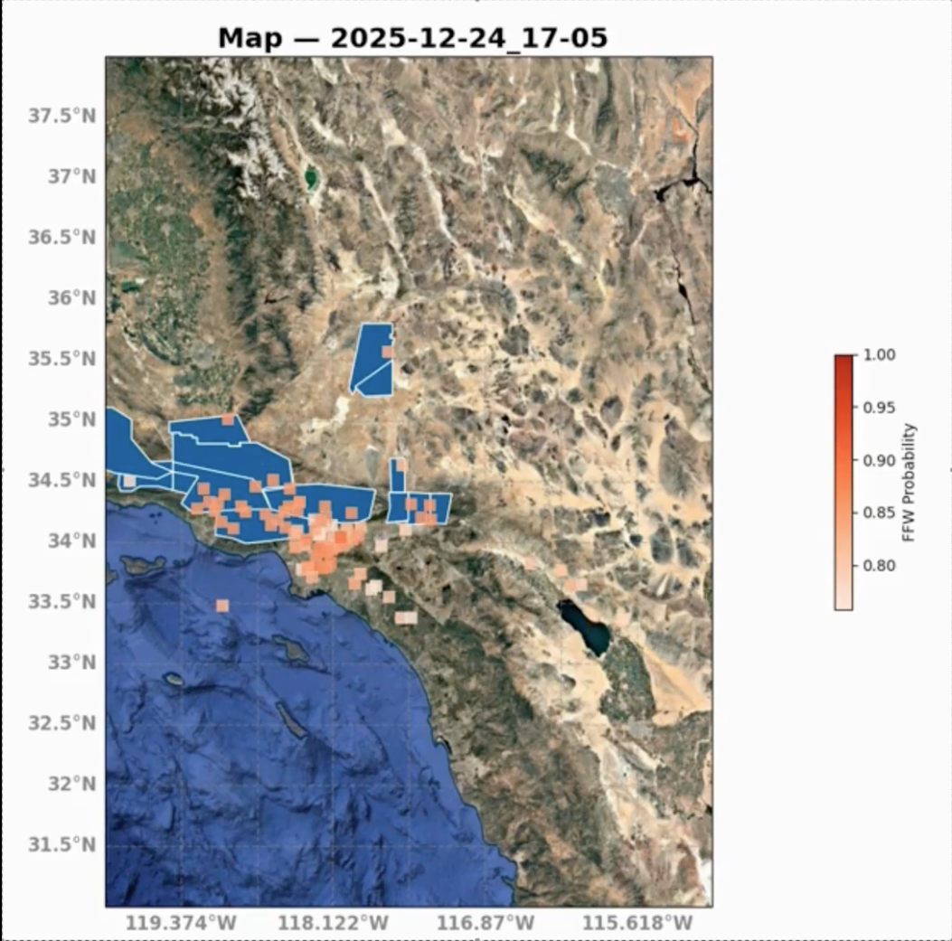
Satellite-based systems help widen the field of view. Instruments can detect changes in surface water, soil moisture, terrain conditions, and storm impacts across broad regions. When combined with local modeling, that information can support earlier and more accurate situational awareness.
The Data Gap Flood Victims Feel First
For residents, the data gap shows up as uncertainty. Is this underpass passable? Is the water still rising? Is my neighborhood at risk, or is the danger downstream? Better flood tracking cannot eliminate that uncertainty entirely, but it can reduce it.
For governments, the gap is operational. Emergency managers need to know where to send crews, which roads to close, and how to prioritize rescue or drainage resources. Engineers need evidence to justify upgrades. Planners need maps that reflect current conditions, not just historical flood zones.
Pro Tip: The most useful flood system is not the one with the most data. It is the one that delivers trusted information quickly enough for people to act.
How UTEP Researchers Could Turn Satellite Signals Into Decisions
Although space-based tools sound futuristic, the practical workflow is surprisingly grounded. Researchers typically combine satellite imagery, hydrologic models, local terrain data, rainfall estimates, and field validation. Each layer helps correct the weaknesses of the others.
- Satellite observations: Detect where water is present or where land surface conditions have changed.
- Rainfall data: Estimate storm intensity and distribution across neighborhoods and watersheds.
- Terrain models: Show how water is likely to move through slopes, channels, streets, and low-lying areas.
- Local validation: Confirms whether the model matches what people and sensors are seeing on the ground.
The technical challenge is speed and accuracy. Flood response is not a research paper timeline. Data must be processed quickly, interpreted correctly, and delivered in a form that decision-makers can understand under pressure.
Why Border And Desert Regions Are A Hard Test
El Paso’s geography makes flood modeling complicated. Desert landscapes can produce flash flooding with little warning, especially when intense rain falls over dry ground or urban surfaces. Water can rush through arroyos, streets, and drainage corridors, creating hazards that change block by block.
Border regions also face coordination challenges. Flood risk does not respect municipal or national lines. Shared watersheds, cross-border infrastructure, and uneven monitoring capacity can make a regional view especially valuable. A satellite-based perspective can help unify fragmented data, though policy and communication still determine how useful the system becomes.
NASA Flood Tracking And The New Climate Infrastructure
For decades, infrastructure was mostly concrete, steel, pipes, and pumps. That is changing. Modern climate infrastructure also includes data platforms, predictive models, sensor networks, and emergency communication systems. UTEP’s research fits into this broader shift: resilience is becoming computational.
This does not mean technology is a magic fix. A better map will not unclog a storm drain, rebuild a washed-out road, or protect homes built in risky areas. But it can expose where investment is most urgent and where outdated assumptions are putting people in danger.
Flood intelligence is becoming as important as flood control. Communities need to know not only where to build barriers, but where risk is emerging in real time.
That has major implications for city budgets. If local officials can show more precise flood patterns, they can make stronger cases for drainage upgrades, federal support, zoning changes, and emergency preparedness. Better evidence can also help prioritize neighborhoods that have historically been underserved or undermeasured.
The Equity Question Behind Better Flood Maps
Flood disasters often punish the same communities repeatedly: lower-income neighborhoods, areas with weaker infrastructure, and residents with fewer resources to evacuate, repair, or relocate. If NASA-enabled flood mapping is deployed well, it can make those risks more visible.
But there is a risk, too. Advanced systems can reinforce inequities if the data is not shared, explained, or used to drive investment. A beautiful flood model sitting inside an academic or agency dashboard will not help a family facing water at the door.
For this research to matter, public communication must be treated as part of the technology stack. That means clear alerts, accessible maps, multilingual outreach where needed, and coordination with local emergency services.
What Comes Next For NASA Flood Tracking
The future of NASA flood tracking will likely be more automated, more local, and more integrated with emergency operations. Expect more use of machine learning to classify flooded areas, better fusion of satellite and ground sensor data, and faster pipelines that turn observations into near-real-time alerts.
There is also a strong case for linking flood intelligence with transportation systems. Road closures, underpass flooding, and stranded vehicles are among the most visible and dangerous impacts of flash floods. If satellite-informed models can help identify likely trouble spots before or during a storm, cities could warn drivers sooner and deploy barricades more strategically.
The same data could influence long-term planning. Insurance risk, housing development, drainage design, and climate adaptation grants all depend on knowing where water actually goes. Historical flood maps are useful, but in a changing climate they are increasingly incomplete.
The Bottom Line
UTEP’s use of NASA technology to track floods is a signal of where disaster science is heading. The most important climate tools will not live only in federal agencies or research labs. They will be adapted by regional experts who understand local terrain, local infrastructure, and local urgency.
The promise is not perfect prediction. Flooding will remain difficult, especially as storms become more extreme and urban systems face growing pressure. But better observation can buy time, sharpen response, and reveal vulnerabilities before they become tragedies.
Why this matters: When space-based science meets local decision-making, flood tracking stops being an abstract technical achievement. It becomes a practical tool for survival, planning, and accountability.
The information provided in this article is for general informational purposes only. While we strive for accuracy, we make no guarantees about the completeness or reliability of the content. Always verify important information through official or multiple sources before making decisions.