Indonesia Missing Ferry Exposes a Maritime Crisis
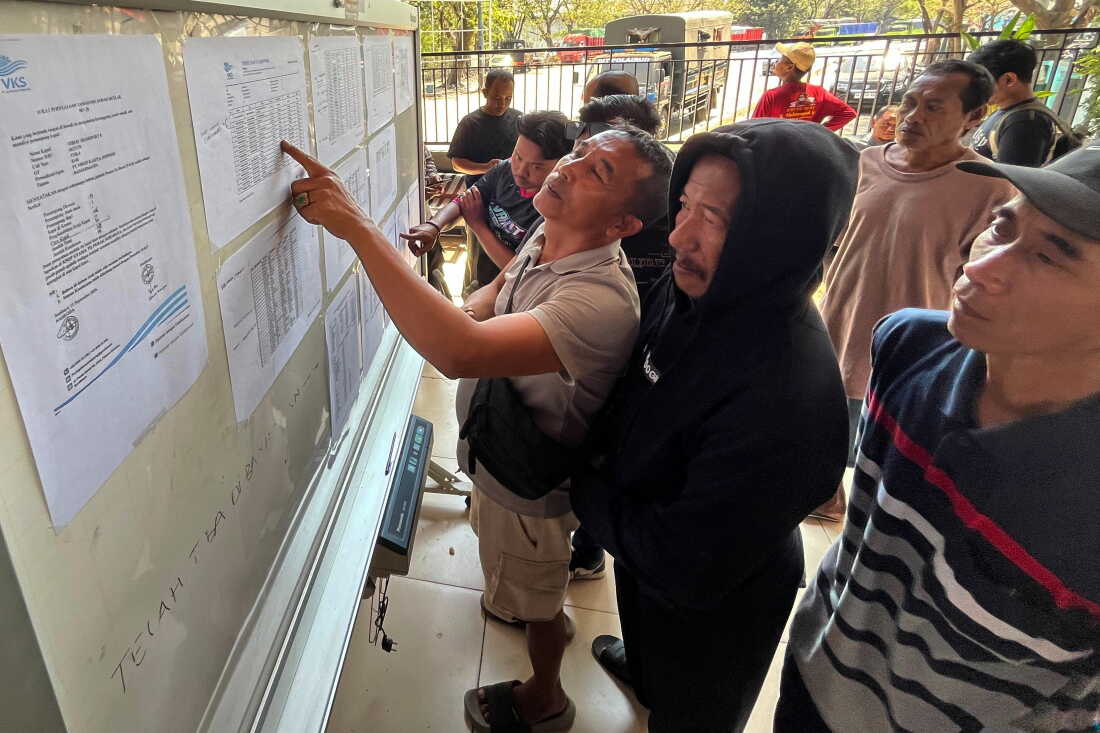
A missing ferry is never just a transportation story. It is a stress test for an entire country’s rescue systems, regulatory muscle, and trust in public infrastructure. The Indonesia missing ferry search now unfolding is a grim reminder that, across an archipelago where boats function like buses, one failure can instantly become a national emergency. For families waiting for word, every hour without a confirmed position feels punishing. For officials, the challenge is brutally practical: narrow a vast search area, verify passenger information, coordinate agencies, and keep hope alive without overstating what is known. Indonesia depends on maritime mobility more than most nations on Earth, but that dependence also magnifies the cost of weak oversight, aging vessels, poor weather calls, and gaps in tracking technology.
- The search highlights the fragility of ferry travel across Indonesia’s sprawling island geography.
- Rescue teams rely on
SAR,AIS, weather modeling, and local reports, but missing data can slow everything down. - Passenger
manifestaccuracy remains one of the most important factors in maritime emergencies. - The disaster risk is not only mechanical failure, but a system strained by demand, weather, and uneven enforcement.
- Indonesia’s next safety leap must combine better technology with stricter accountability.
Indonesia Missing Ferry Shows a Fragile Lifeline
Indonesia is the world’s largest archipelagic nation, and ferries are not a niche mode of travel. They are economic infrastructure, family infrastructure, school infrastructure, and medical infrastructure. When a ferry goes missing, the disruption is immediate and human. People are not just stranded; communities are severed from the routes that connect jobs, hospitals, markets, and relatives.
That is why the Indonesia missing ferry case carries weight beyond the search zone. Ferries often operate in environments that are more complex than they appear from the dock: fast-changing currents, crowded sea lanes, sudden storms, and inconsistent communications coverage. Add night travel or poor visibility, and a routine crossing can become a rescue scenario with very little warning.
The hard truth is that ferry safety is public safety. If a country relies on boats like buses, it has to regulate them like critical infrastructure.
Search operations typically begin with a deceptively simple question: where was the vessel last confirmed? If there is a working AIS signal, a GPS position, a radio call, or a port departure record, rescuers can build a starting grid. If those signals are absent, stale, or contradictory, the mission becomes much harder. The ocean does not preserve evidence neatly. Wind and current move debris, survivors, and lifeboats away from the last known point.
How Search Teams Build the Rescue Picture
Modern maritime search looks high-tech from the outside, but in practice it is a tense mix of data, judgment, and local knowledge. Agencies may combine aircraft, rescue boats, navy assets, police units, port authorities, fishermen, and coastal communities. The best operations depend on fast coordination through an incident command system, not improvised phone chains.
The first priority is defining the last known position
A reliable last known position can shrink the search area dramatically. Teams examine departure time, intended route, sea conditions, fuel range, radio contact, AIS pings, and any emergency beacon such as an EPIRB. If the ferry never transmitted a distress call, that absence becomes its own clue. It may suggest a sudden event, equipment failure, power loss, or a communication blackout.
The second priority is matching the passenger record to reality
Rescue planning depends on the manifest. A clean list tells authorities how many passengers and crew may be missing, how many life jackets or rafts were required, and how to notify families. But in many ferry systems, especially on busy local routes, passenger counts can be messy. Late boarding, informal ticketing, and incomplete identification create confusion when precision matters most.
Pro tip for operators: a digital manifest is not a luxury feature. It is a rescue tool. Real-time passenger records, crew rosters, and emergency contact data can cut hours from the response timeline and reduce the anguish of uncertainty for families.
The third priority is reading the sea like a moving crime scene
Search teams model drift using wind, tide, waves, and current. This is where SAR planning becomes intensely technical. A life raft, a floating cooler, a wooden panel, and a person in the water will drift differently. Even a few hours can expand the search area from manageable to massive.
That is why early reports from fishermen, coastal residents, and nearby ships matter. A single sighting of debris or a faint radio transmission can redirect the entire mission. In countries with thousands of islands, human networks still fill gaps that satellites and transponders miss.
What the Indonesia Missing Ferry Search Reveals
The deeper issue is not whether one ferry had a specific mechanical fault, bad weather encounter, or communications failure. The larger question is whether the system gives vessels enough redundancy before they are in trouble. In maritime safety, redundancy is everything. If the engine fails, there should be backup power. If radio fails, there should be another communication channel. If visibility collapses, navigation systems should still work. If the vessel lists, passengers should know where to go.
Many ferry tragedies around the world follow familiar patterns: overcrowding, poor maintenance, outdated safety gear, inaccurate manifests, delayed distress signals, weak inspections, and pressure to sail despite risky conditions. None of those issues is glamorous. All of them are fixable.
The most dangerous phrase in ferry operations is routine crossing. Familiarity can make risk feel smaller than it is.
For Indonesia, the challenge is scale. Regulating a dense network of routes across thousands of islands is harder than overseeing a few centralized airports. Smaller ports may have fewer inspectors, less advanced equipment, and greater pressure to keep boats moving. Weather conditions can differ sharply across short distances. A trip that begins under acceptable conditions may encounter dangerous seas before reaching the next port.
Technology Can Help but It Cannot Replace Enforcement
The obvious answer is more technology, and yes, Indonesia’s ferry network would benefit from wider use of AIS, satellite tracking, digital manifest systems, automated weather alerts, and emergency beacons. A vessel that can be seen in real time is easier to rescue than one that disappears into a blank patch of water.
But technology without enforcement becomes dashboard theater. A broken AIS transponder still looks like a policy success if nobody checks whether it works. A digital checklist is useless if crews are pressured to ignore it. A weather warning system means little if port authorities lack the power or will to halt departures.
- Tracking: Require functioning
AISor equivalent monitoring on passenger ferries, including smaller regional routes. - Records: Move from paper passenger lists to verified digital
manifestsystems. - Training: Conduct regular evacuation drills for crew and realistic emergency briefings for passengers.
- Weather decisions: Give port authorities clear authority to suspend sailings based on risk thresholds.
- Maintenance: Audit engines, radios, life rafts, pumps, and emergency lighting before problems become disasters.
Why This Matters Beyond One Ferry
A missing ferry is a national story because it exposes the thin line between mobility and vulnerability. Indonesia’s islands need affordable transport. Overregulation that makes travel impossible would hurt ordinary people. But underregulation makes those same people absorb unacceptable risk.
The right answer is not to demonize ferries. It is to modernize them. Ferries can be safe, efficient, and essential when operators, regulators, and port authorities treat safety as a daily operating system rather than a post-disaster press conference.
There is also a climate dimension. More volatile weather, stronger storms, and shifting sea conditions will put additional strain on maritime transport. Search and rescue teams will need better forecasting, better communications, and faster cross-agency coordination. Ferry operators will need clearer no-sail rules. Passengers will need more reliable information before boarding.
The Accountability Question Comes Next
Once the immediate search phase ends, attention should turn to accountability. Investigators will need to examine the vessel’s condition, route planning, crew training, weather data, communications logs, passenger records, and port clearance process. The goal should not be a symbolic punishment. It should be a forensic map of what failed and what must change before the next voyage.
That requires transparency. Families deserve timely updates, not vague assurances. Operators deserve clear standards, not shifting blame. Regulators need the budget and authority to inspect, suspend, and enforce. The public needs to know whether the system is learning or merely waiting for headlines to fade.
The Indonesia missing ferry search is a human emergency first. But it is also a policy warning. In an island nation, the sea is not a gap between places. It is the road. And every road needs rules, maintenance, monitoring, and accountability. If Indonesia can turn this moment into stronger maritime governance, the legacy of a frightening search may be a safer future for millions who step onto ferries because they have no better way to move.
The information provided in this article is for general informational purposes only. While we strive for accuracy, we make no guarantees about the completeness or reliability of the content. Always verify important information through official or multiple sources before making decisions.