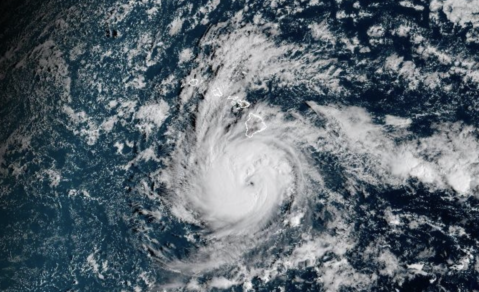
Nantucket Shipwreck Resurfaces After Storm
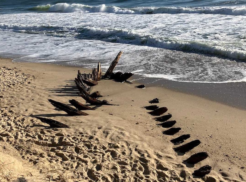
Nantucket Shipwreck Resurfaces After Storm
A storm can do what decades of searching cannot: strip away sand, crack open a coastline, and pull history back into view. The newly exposed Nantucket shipwreck is more than a curiosity for beach walkers. It is a reminder that New England’s coast is not a fixed edge of the map but a moving archive, constantly edited by wind, tides, and rising seas. After a powerful nor'easter battered the island, remnants of an old wooden vessel reportedly emerged from the sand, turning a familiar shoreline into a live archaeological site. For coastal communities, the discovery lands at an uneasy moment. Climate-driven erosion is accelerating, storms are intensifying, and cultural history is becoming harder to preserve before the ocean takes it back.
- The storm-exposed wreck highlights Nantucket’s deep maritime past and fragile coastal geology.
Nor'easterevents can rapidly reveal or destroy archaeological material buried for centuries.- Experts will likely rely on wood analysis, mapping, and archival research to identify the vessel.
- The find underscores a broader preservation challenge as sea-level rise reshapes historic shorelines.
Why the Nantucket Shipwreck Matters Now
Nantucket has always been defined by ships: whaling vessels, merchant schooners, fishing boats, ferries, and wrecks. Its surrounding waters are beautiful, but they have never been gentle. Shifting shoals, hard weather, and limited visibility made the region one of the more treacherous maritime corridors in the Atlantic. A Nantucket shipwreck appearing after a coastal storm is not just an isolated discovery. It is a physical reminder of the island’s economic engine, its risks, and the people who built their lives around dangerous water.
The timing is what makes this moment feel especially modern. Archaeologists have long understood that beaches are unstable, but the pace of change is now difficult to ignore. A wreck that spent generations hidden under sand can appear for a few days, then vanish again under sediment or be torn apart by the next tide cycle. That creates a brutal clock for researchers: document fast, disturb little, and assume the ocean is already negotiating the artifact’s future.
Key insight: Storms do not simply uncover history. They decide which parts of history get a second chance to be studied and which disappear forever.
The Deep Dive on the Nantucket Shipwreck
What a Nor’easter Can Do to a Buried Vessel
A nor'easter is not just a windy storm with a dramatic name. It is a powerful coastal system, typically driven by winds from the northeast, that can generate storm surge, intense wave action, and rapid beach erosion. For an object buried in sand, those forces behave like a massive natural excavation tool. Layers that accumulated slowly over decades can be removed in hours.
That is why shipwrecks sometimes seem to appear overnight. The vessel did not arrive suddenly. The protective cover around it did. Sand can preserve wooden hull sections by limiting oxygen exposure and shielding them from sunlight and mechanical damage. Once exposed, however, the same timbers become vulnerable to drying, cracking, marine organisms, and souvenir hunters.
Pro Tip: If you encounter a wreck or artifact on a beach, do not remove pieces, pry at timbers, or post exact coordinates publicly. The best first step is to photograph the object from a safe distance, note the general location, and alert local authorities or preservation officials.
How Experts May Identify the Vessel
The first challenge is separating romance from evidence. A visible hull fragment may look like a legendary lost ship, but identification requires slow, technical work. Researchers would likely start with photogrammetry, a method that stitches overlapping images into a measurable 3D model. They may also use GPS mapping to record the wreck’s position before tides alter the site.
Wooden components can offer clues. The species of timber, tool marks, fastening patterns, and hull construction style may point to a time period or vessel type. If researchers can safely sample a piece, dendrochronology may help estimate when the tree was cut by comparing growth rings against regional chronologies. Metal fasteners, if present, can also speak volumes. Iron spikes, copper sheathing, or treenails can narrow the construction era and intended use.
Then comes the paper chase. Maritime historians would compare field evidence with shipping records, insurance documents, local newspapers, lifesaving station logs, and harbor records. Nantucket’s maritime history is unusually rich, but that does not guarantee a clean match. Many vessels wrecked in coastal waters were poorly documented, misreported, or known under changing names.
Why Sand Is Both Protector and Threat
Sand is often treated as the enemy because it hides things. In archaeology, it can be an ally. When a wreck is sealed beneath wet sediment, the environment may slow decay. That protective burial can keep organic material stable long enough for future researchers to study it with better tools.
Exposure flips the equation. Sun and air can begin damaging waterlogged wood quickly. If the tide repeatedly covers and uncovers the wreck, expansion and contraction can weaken the structure. Debris dragged by surf can scrape exposed timbers. Curious visitors can unintentionally accelerate the loss by stepping on fragile elements or taking fragments as keepsakes.
This is why preservation teams often face a difficult decision: leave the wreck in place, rebury it, document it and let nature proceed, or attempt recovery. Full recovery sounds dramatic, but it is expensive, technically demanding, and not always the best option. Conserving waterlogged wood can take years and requires controlled treatment, storage, and funding.
Why This Matters Beyond Nantucket
The story of the Nantucket shipwreck is part of a larger coastal reckoning. Across the United States and beyond, archaeological sites are being exposed by erosion faster than institutions can study them. Indigenous sites, colonial settlements, burial grounds, military installations, and shipwrecks are all under pressure from changing coastlines.
For communities, these discoveries can feel thrilling and alarming at the same time. A wreck can boost local attention and deepen civic pride, but it can also expose how vulnerable heritage infrastructure really is. Museums, universities, and state agencies rarely have unlimited rapid-response teams waiting for the next storm. In practice, preservation often depends on coordination among residents, historians, local officials, and scientists.
There is also an economic layer. Coastal tourism thrives on heritage, but heritage sites need protection. A newly visible wreck may draw crowds, and crowds bring both awareness and risk. The smarter model is managed access: public education without turning a fragile site into an uncontrolled attraction.
The Climate Signal Beneath the Discovery
No single exposed wreck can be blamed neatly on climate change. Storms have always hit Nantucket. Shipwrecks have always emerged from shifting beaches. But the broader pattern matters. Warmer oceans can feed stronger storms, and higher baseline sea levels allow storm surge to reach farther inland. That means more frequent disturbance of places once considered relatively stable.
For maritime archaeology, this changes the job. The field is no longer only about discovering the past. It is increasingly about triage: deciding what can be documented, what can be saved, and what must be digitally preserved before it disappears. Tools like LiDAR, side-scan sonar, drone mapping, and 3D modeling are becoming essential not because they are flashy, but because the window for fieldwork is shrinking.
The uncomfortable truth: Climate pressure is turning coastlines into emergency rooms for cultural history.
What Happens Next
The most responsible path begins with documentation. Before anyone speculates too aggressively about the vessel’s identity, experts need a site map, high-quality imagery, measurements, and environmental notes. If the wreck remains exposed, researchers may monitor how quickly it is changing. If it starts to destabilize, protective action could follow.
Local engagement will matter. Residents often become the first line of discovery because they walk the same beaches day after day. Their observations can help experts understand when the wreck appeared, how much of it is visible, and whether the site is changing. But that public role works best when paired with clear guidance: look, document, report, and leave the material in place.
The bigger opportunity is educational. A wreck like this can make maritime history tangible for people who might never read a technical report. It connects weather, commerce, labor, navigation, risk, and environmental change in one dramatic object. That is rare. And if handled carefully, the discovery can become more than a fleeting storm story. It can become a case study in how coastal communities adapt to a future where the past keeps washing ashore.
The Bottom Line
The reappearance of a Nantucket shipwreck after a nor'easter is exciting, but the excitement comes with responsibility. This is not just driftwood with a backstory. It is evidence: of shipbuilding, trade, weather, loss, and survival. It is also a warning that the same forces revealing the past are capable of erasing it.
Nantucket’s coastline has always been dynamic, but the stakes are rising. Every exposed timber is a prompt to act faster, document better, and treat local history as something living in a harsh environment, not locked safely behind glass. The ocean has reopened the archive. The question is how much we can learn before it closes again.
The information provided in this article is for general informational purposes only. While we strive for accuracy, we make no guarantees about the completeness or reliability of the content. Always verify important information through official or multiple sources before making decisions.